

Thursday, November 11, 2010
Didn't Make Chuck Town
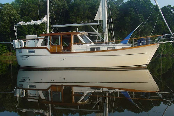
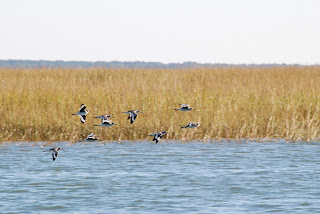
We had planned to be in Charleston, SC harbor tonight, but it didn't happen. Due to a low tide in a tight anchorage in Georgetown, SC, we decided to delay our departure this morning. Instead we had breakfast and a latte in a great little breakfast place. Before Charleston harbor is the Ben Sawyer Highway Bridge, vertical clearance 31 feet (Serenity's mast is 42 feet above the waterline), and openings are restricted between 4 and 6 PM. Our arrival time would have been 4:45 PM, with sunset at 5:30. The math didn't work, so we are anchored behind Big Hill Marsh Island, or at 32 50.222 N/079 43.844W. Rather uneventful day on the ICW, but some of the wildlife was interesting. Besides the birds, we were entertained by several dolphin sightings.

Wednesday, November 10, 2010
Georgetown, SC

Paper Mill in Background
Our guide book describes Georgetown as, ...small-town, quiet facade, coupled with surrounding natural beauty, belies the historic and economic significance of the area." The Waccamaw River leading to Georgetown is described as the most beautiful section of the ICW. "It is an area of swamps, marshes, endless deep creeks and dense forests." Both descriptions are correct. We were quite taken by Georgetown. The main street commercial area is stately, while the back side wharf area is nicely shabby chic.
While enjoying the ride down the Waccamaw River we met these tug delivering dredging pipe to Morehead City.

On the VHF radio, they were not shy about stating their intention of taking their half of the waterway out of the middle.
There are little hints that are we getting into the South. We are the ones with the accents, and the term redneck is no longer derogatory.

This guy is using power tools!
I have been getting several inquiries about Serenity's performance. Mechanically, she is doing great. Previously we averaged 1.7 gallons per hour fuel burn. On the first fill up in Beaufort, NC we averaged 1.2 gallons per hour. I think the prop tune and and the slick bottom receive the credit. We did have the sails up in the Chesapeake and Albemarle Sound, but down the "ditch" it has been motoring. Considering that we added numerous new systems, the teething has not been too bad. The unit that should convert analog engine information to NEMA 2000 has been disconnected because it was interfering with the analog gauges (working with the manufacturer). As previously mentioned our much beloved WiFi enhancer went south and was replaced with a new one. Just received news that the old one has been repaired and shipped (will become a backup). The AIS unit was just given last rites and I will be contacting the manufacturer tomorrow for warranty. The new electric toilet and other systems are performing flawlessly, especially the new Raymarine navigational systems.
Tuesday, November 9, 2010
South Carolina
Serenity might be further south than she has ever been. I think the previous owners kept her up in Maine. After Bald Head Island, we back tracked up the the Cape Fear River and rejoined the ICW. The biggest angst of the day was timing an old pontoon bridge that only opened on the hour. The bridge is scheduled to be replaced by a 65' foot fixed bridge in December 2010.


Soon to retire (new bridge in background)
We ended up at Barefoot Landing Marina. Previously this was a free dock associated with the 30 some nearby Myrtle Beach restaurant and shopping center. Evidently, too popular as now they charge. Again we had a good bike ride and even found a new activity - beach riding.

Bald Head Island
The short run down the Cape Fear River was aided by a strong current so we were able to ride around almost the entire island on our bikes after we arrived.


Pollie & Old Baldy Lighthouse (1817)
"The exceptional nature of Bald Head Island, NC," is very interesting. Seems that in the 60's there was a big fight between environmentalist and developers over Bald Head Island. The resulting compromise is quite nice, and apparently economically feasible. While there does not seem to be any service industry housing, the rest is quite nice and blends nicely with the environment. They have regulations such as requiring baffling around porch lights so as not to confuse the baby sea turtles. They are very proud of the fact that the lack of light pollution makes stargazing possible, but we also found that riding our bikes to the restaurant at night to be rather challenging. There are three environments: the creek side, forest, and beach.

"That way to the Bahamas"
The marina was one of the nicest we have stayed in, and the nearby restaurant, Eb & Flo's, had great shrimp and grits.

Saturday, November 6, 2010
Tidal Action
While in Wilmington, Serenity has been enjoying a floating dock without any nearby company, but the Hilton. Always better to be the view than to have the view.


 We have decided that the prudent course of action for our departure on Monday is to wait for the ebb, so we will not be taking off until after noon. Because we will not be able to make it too far before sunset, we are going to stop at Bald Island, about a 24 mile run.

We have observed about a five foot range between between low and high tide. Notice the ramp in relation to the floating dock and the fixed dock in the first picture with Pollie versus the second picture Pollie and nephew Bill.


Friday, November 5, 2010
Playing Battleship!
Hi folks this is Pollie getting brave and doing a post this time.
Today we did the tourist thing after two days of rain and caught the Battleship North Carolina in all her sunlit glory. Huge ship, we got lost down below...The views of Cape Fear River historic waterfront were impressive from the uppermost decks. We could even see our boat across the river!
 I think we had too much fun :)) Loved these photos so had to buy them all... I'm such an easy target.
Today we did the tourist thing after two days of rain and caught the Battleship North Carolina in all her sunlit glory. Huge ship, we got lost down below...The views of Cape Fear River historic waterfront were impressive from the uppermost decks. We could even see our boat across the river!

Wednesday, November 3, 2010
Wilmington, NC
We did a long day from Swan Point, NC, down the ICW past Carolina Beach, through Snow's Cut, up the Cape Fear River to Wilmington City Docks (34 14.306N/077 57.090W). It was a day of fast and slow. Once we had to put the peddle to the metal to make a bridge opening, then we had to slow down to time the next bridge. The current from the inlets to the Atlantic Ocean played with us also. At times over a knot of speed was shaved off by current, ant other times we were flying:

 Before getting to the Historic District of Wilmington, you past the industrial side of town, but then you get some better views.


9.4 Knots was our best!
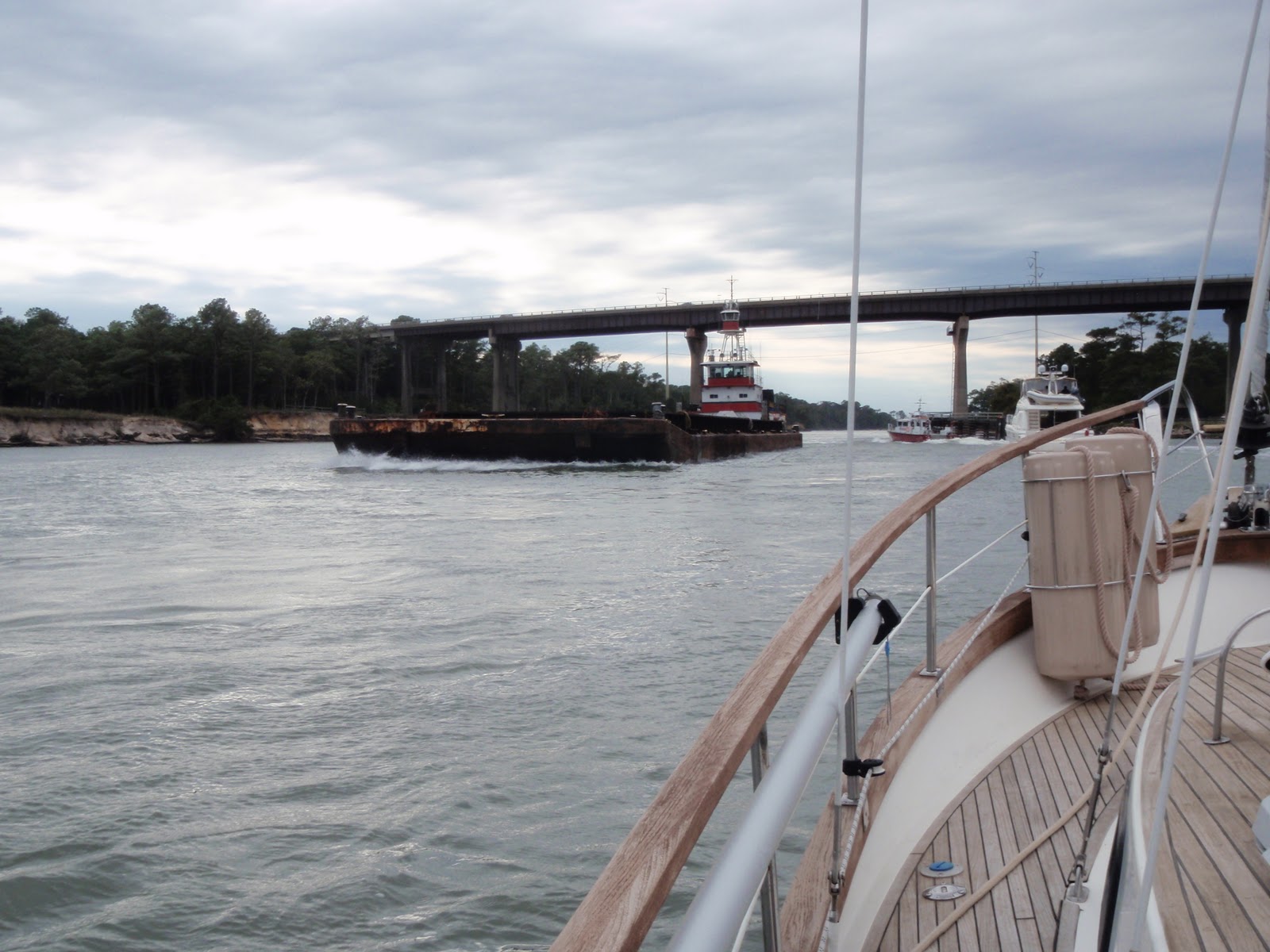
Under the Carolina Beach Bridge over Snow's Cut, we decided to give this guy the right of way, like the boats ahead of did.

We plan on staying here until Monday visiting with my sister and brother-in-law (Judy & Charlie). We already have the new WiFi enhancer installed, and Judy's wash & fold has us in clean clothes.
Subscribe to:
Posts (Atom)